Zoning of the national park
Four zones with different protection regimes - strictly protected, regulated use, recreation and economic use: what each allows and how large it is.
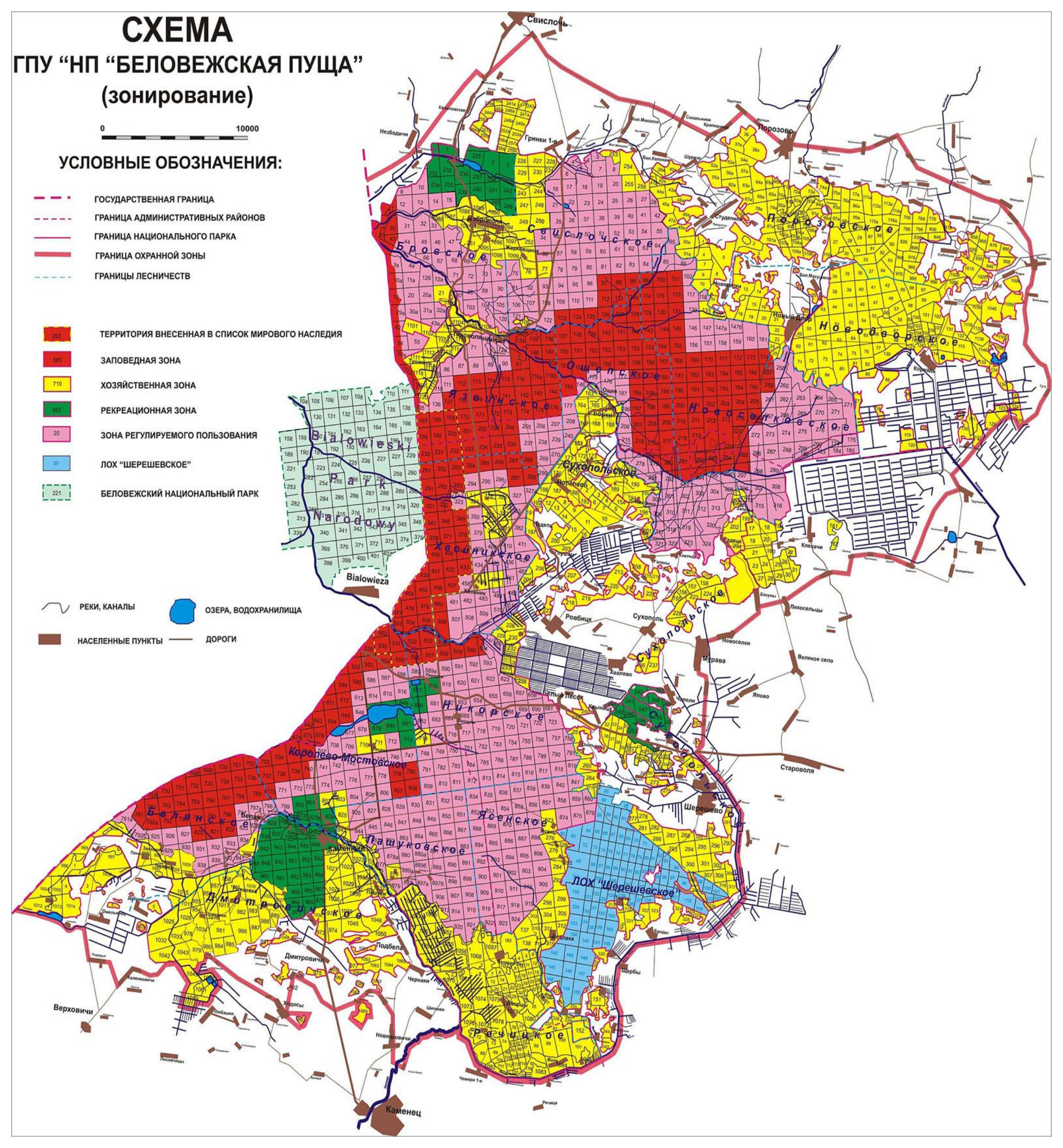
The national park is divided into four functional zones with different protection regimes. Their boundaries and areas are set by the Regulation on the National Park, approved by Presidential Decree No. 59 of 9 February 2012 (as amended in 2016). Around the park lies a buffer zone of about 64,000 hectares.
| Zone | Area, ha | Share of the park |
|---|---|---|
| Strictly protected | 58,296.8 | 38.8 % |
| Regulated use | 37,905.3 | 25.3 % |
| Recreation | 8,007.6 | 5.3 % |
| Economic use | 45,873.6 | 30.6 % |
| Total | 150,083.3 | 100 % |
Strictly protected zone
A benchmark of nature and a reserve of genetic diversity: old mixed conifer and broadleaf forests developing without human interference. All economic activity is banned here; only protection and research are allowed. The strictly protected zone cannot be visited without the park's permission. In 2012 it was almost doubled - previously it covered about 30,000 hectares.
Zone of regulated use
Here typical forest ecosystems are preserved and restored. Use of natural resources is limited and subordinate to conservation, and educational and ecological tourism follows special trails with guides or park specialists.
Recreation zone
An area for leisure and educational tourism: the nature trails, the Museum of Nature, the wildlife enclosures and Father Frost's Estate are here, and public events take place here.
Economic zone
The villages, the park's services and production facilities, hotels and visitor facilities; forestry and farming are carried out here within limits acceptable for a national park.
The zoning plan at the top of the page comes from the old website and shows the zones before 2012; the current boundaries are in the Regulation on the National Park on the park's website.